
Another Friday evening at Lebel with the crew in action — making letters stand up, cutting maps, interpreting law, and designing impossibilities.
Above, Michelle, Josh, and Mike Marcon discuss what materials will work best to line the extruded part of the plywood letters.
It was, in short, a great night.

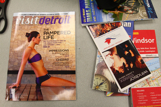
Michelle brought another pile of curiosities of the Windsor and Detroit tourism industry.

The tools for the night’s activities.

Kevin woke up just in time to come.

Daragh had sent over a large timeline / flowchart image outlining his progress and plans for the Storefront Residencies for Social Innovation documentary he shot last summer. Bet you had almost forgotten, right? Well, you would be sorely mistaken. Daragh has been hard at work editing, and Michelle has been traveling up to Toronto to help. Maybe she’ll post this graphic?

Michelle walks us through Daragh’s plans, Karlyn and Josh look on.

Danielle pretended to be shocked about something. Ha!

Some ideas and directions for Daragh’s documentary on SRSI.

The email that got sent out to announce HOMEWORK to our mailing list. Oh, you’re not on our mailing list yet? Why not sign up? There’s a little form on the front page, in the sidebar.

Two cities, two maps. Windsor + Detroit.

Josh sports Spotvin’s shirt.

Over in the sculpture area in Lebel, Kevin, Karlyn and Hiba start moving around the faces of the letter R.

The plan was to build the supports between the two faces so that the letter could stand on its own.

Maneuvering a large letter R.

They had assembled the two faces last week (or was it over reading week?)

The 2x4s to be used for supports.

Back in Room 135, Michelle takes scissors to maps.

Meanwhile, Danielle pulls up her initial research on border architecture and new border laws and starts to invent.

Michelle cut out the Detroit river from a Windsor activity guide map.

And started to attach it to a map of Detroit.

The scale wasn’t perfect.

But it would be useable.

Then, the overlap started. Michelle removed the river entirely. This would be great with maps on transparencies!

I started doing some preliminary design ideas for our cross-border portals.

To get the scale of map that would accurately show the scale of portals will be tough. We might have to look at just pointing out the general portal locations on a map, rather than pinpointing their places, per say.

Also, some initial ideas for a guide of some kind for our portals.

Rosina and Danielle get in on the map-talk.

Trying to line-up streets in Windsor and Detroit. I can’t recall which ones lined up — could you follow up on this Michelle?

The plan of attack for the letter R from Hiba’s notebook.

And, Danielle’s notebook on border law.

Refining some portal design ideas.

Windsor / Detroit / Belle Isle.

Density examined.

A remainder.

Back in the shop, the cross-supports start going in.

Kevin’s trusty saw — it started smoking halfway through the job.

Hiba, Josh, and Kevin at work on the letters.

Josh readying the tools.

And the maiden screw for cross-supports goes in.

Technique!

More revisions of the portal guide / route map. I’m imagining this similar to any other city-based public transit guide.

Danielle’s border architecture brainstorm — invented architecture and tactics for breaking through it.

Ideas for how to jump over a large wal…

The letter moves ahead.

More supports.

Josh looking particularly epic.

Some of my Sketch-Up ideas for portals.

I’m particularly terrible at this program.

But, the mistakes still look interesting to me.

Cross-Border Portals in 3D .

And, a little icon for our portals.

Fancy colours. Who wouldn’t want to jump into one of these?

The letter faces combined.

One of the cross-supports.

The letter R stands on its own! An amazingly productive Friday night, again!!!!!!
How to Forget the Border Completely and HOMEWORK: Infrastructures & Collaboration in Social Practices are generously supported by the Ontario Arts Council.

D-W new geography follow-up:
After we cut out the river, we started playing around with placements:
We put Hart Plaza at University and Ouellette
We lined up both McDougall streets in Windsor and Detroit (they run parallel)
Then we made a list of all the streets in both Windsor and Detroit that have the same name, thinking that’s a good starting point for connecting the cities.
Jefferson in Detroit could lead into Jefferson in Windsor, for example.
Can’t wait to keep exploring this!
So awesome! sweet post and great cross-border portal route map!!
I can’t wait to do some more work on the letter. I kind of want to make a base.
but where is the river going to go? while it does act as natural border, it does provide sustenance. looking forward to more developments and updates on this project.
Leesa you bring up a very good point. We’ve started by cutting out the maps and physically re-locating and connecting roads together, thus changing the geography of the region. It’s been useful so far in finding parallells between the two cities, and it’s pretty relaxing and enjoyable to sit and look at a map for an hour or two. I think this will mostly likely get translated into a digital cross-river transportation infrastructure including or similar to the portals that have started to get fleshed out. I think inventing some type of subway system might even be pretty cool.
Thanks for the comment!
Good question, Leesa.
Maybe Michelle is thinking about turning it into an underground lake (or, rather, river)? But, you’re right, erasing the river erases more than just the border.
I still want to figure out a way to render a huge number of pedestrian crossings. I think Josh started on that…
Thom Provost should get in for that!!!