Google Street View is Coming to Windsor

streetview

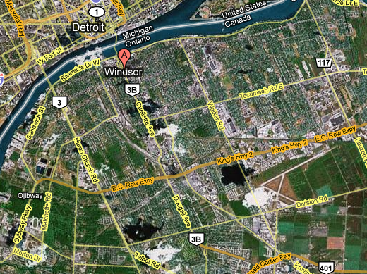
Google’s Street View service is making the rounds across Canada. There’s no schedule that I’ve been able to find yet, but they are coming to Windsor.

Anyone have any ideas about when Google is coming to town?

And maybe as a follow up, anyone have any ideas?

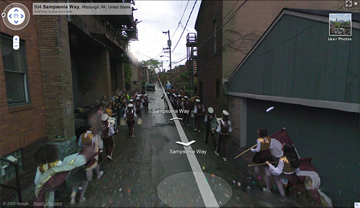
There’s already a short history of artists working alongside Google’s team. In 2008, artists Robin Hewlett and Ben Kinsley invited the Google Inc. Street View team and residents of Pittsburgh’s Northside to collaborate on a series of tableaux (pictured above), but to not at least think about doing something would certainly be a waste. How often do you think this could possibly happen?

I wonder if a well-placed, but legible, banner might be worth investigating?

[via CBC]

Windsor Archives

a map of Windsor

I went to the Windsor Archives at the downtown Windsor Public Library with Lee Rodney’s Border Culture class on Thursday. The city’s archives are uninsured and sit in the basement, in the same room as the water main for the building, with some record books, maps, and architectural drawings un-boxed and unprotected, though most looked to be in acid-free (though certainly not water-proof) boxes.

The map above was one of the many articles from the archive we got to see, and I think it dates to sometime in the 1950s. Interestingly, there are these areas marked as abandoned, and it made me think back to our beginnings at a Google map that marked out, among many things, some of the abandoned properties (in particular, the abandoned big-box stores).

I’m curious as to why these areas were ever marked as abandoned, though unfortunately I didn’t note what kind of map this was. If anyone has any guesses, let me know.

So, the Windsor Archives are a really interesting place if you’ve never been, and the archivist that we met with seemed very eager to help with researching. With over 10,000 photos alone, on top of thousands upon thousands of other documents, I think it’s worth exploring further.

They also accept contributions.

Mapping Windsor

Mapping Study Areas in Windsor via Google Maps

Next Tuesday night, December 2nd, at 7pm, Broken City Lab will be holding a Social Mapping Event, where we’ll use the tools Google gave us and highlight potential study areas (and broken points of interest)—the Google Map itself will be made public afterwards. We’ll also make a screencast of the process and make it available on the website afterwards.

So, if you’ve been meaning to come out to our weekly Office Hours, but haven’t had the time yet, clear your schedule for next Tuesday.