")
Not exhaustive, nor complete, this map is a work-in-progress, documenting a community in-transition. For one afternoon in February 2010, we gathered together with a group of community members to create two distinct lists: Sites of Apology and Sites of Hope.
The locations identified as part of these two lists were noted as being places for which we, as a community, might need to apologize to future generations, or places for which we might hold some particular hope of their role in creating a better city for future generations.
Over the following weeks and months, we gradually visited every site on the list to (un)officially recognize it, demarcating it with a large ribbon and saying a few words about its designation. We encourage you to make your own visit to these sites.
Thank you to everyone who contributed to the list and had such an incredible and engaged conversation with us that day. This map is long overdue, but we hope it was worth the wait.
You can download the Sites of Apology / Sites of Hope Map (11″x17″).
")
The text above is from the map itself. We’re hoping to gradually distribute these in print.
")
The map went through a lot of design iterations, though we feel that this version best presents the sites — that is, as places to explore, connect, and demarcate for yourself, rather than documenting our process of demarcation with the ribbons. We recognized these sites in just one way of many, and if you take on exploring these sites yourself, please let us know!
And here’s the listing of sites… Sorry they’re not noted as being either a site of apology or site of hope. If you’re really curious, you should download the PDF.
1. Forgotten Street Car Rails / 2. Sandwich Post Office / 3. Forster High School / 4. Huron Church and College Avenue Intersection / 5. University of Windsor Parking Lots / 6. Indian Road Neighbourhood / 7. Indian Road Houses / 8. Assumption Church / 9. Eco House / 10. Atkinson Park / 11. Grace Hospital / 12. Empty Lot Beside Art Gallery of Windsor / 13. Art Gallery of Windsor / 14. St.Clair Centre for the Arts / 15. Downtown Bus Terminal / 16. Canderel Building / 17. Charles Clark Square / 18. The Old Bus Terminal/ 19. The Old Bus Terminal Being Used for the Downtown Farmers’ Market / 20. Phog Lounge / 21. Artcite Inc. / 22. Capitol Theatre’s Potential / 23. Capitol Theatre Being Closed / 24. City Hall’s Inaction / 25. City Hall’s Occasional Good Decisions / 26. Windsor Workers’ Action Centre / 27. The Clock Being Invisible / 28.The Armouries / 29. Glengarry Avenue and Assumption Street / 30. Houses East of the Casino / 31. Riverfront Ampitheatre / 32. Tim Hortons / 33. Jackson Park / 34. Erie Street Business District / 35. Motor Burger Transitioning from Noi / 36. Made in Windsor (RIP) / 37. Peabody Building Closed Down / 38. Windsor Pride / 39. Taloola Cafe / 40. Artist Studios Lost in the Fire / 41. Drouillard Road / 42. Former School Building Converted to Housing / 43. Epic Buildings Boarded Up / 44. Pelee Passage Light House / 45. Ganacho Trail / 46. WFCU Centre / 47. Zalev Brothers Scrap Yard / 48. Devonshire Mall / 49. Dense Suburbs / 50. Walker Road Big Box Stores
")
And here’s the map layout for 18″x24″, of which we’ve made a few prints.
Below are most of the photos from our gradual demarcation activities. There are a few site photographs that were pulled from screenshots of old iPhoto libraries, and a few others that are entirely MIA. We thought about going out and reshooting them, but the fact is that we already visited those sites and we recognized them, and now, we’re really hoping you’ll do the same.
So, presented in the order that we demarcated the sites (and not in the order as they appear on the map, which is west to east), without further adieu, the Sites of Apology and Sites of Hope of Windsor, Ontario as determined by a small, but dedicated group of Windsorites back in February 2010.

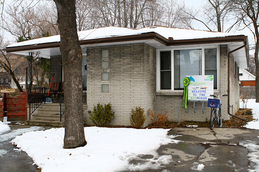
The Ecohouse

Assumption Church

Indian Road

The neighbourhood around Indian Road

Sandwich Post Office

Forgotten streetcar tracks

Forster High School

University of Windsor parking lots

Atkinson Skate Park

Downtown Bus Terminal

Community Museum

Canderel Building

St.Clair College downtown renovations

Phog Lounge

The Capitol Theatre

Artcite

Windsor Workers’ Action Centre

Windsor Pride

Old bus station

The Armouries

City Hall

Charles Clark Square

The hidden clock

Vacant Tim Hortons

Jackson Park

Riverfront Amphitheater

Burned down studios

Erie Street BIA

Drouillard Road

Big box complex

Devonshire Mall

Zalev’s scrap yard

Endless subdivisions

College Avenue and Huron Church

Grace Hospital

Converted buildings (old schools to lofts)

Ganatchio Trail

East Riverside buildings


Made in Windsor (RIP)
Broken City Lab: Save the City was generously supported by the Ontario Arts Council.

Such an epic post, Justin!
The map turned out very nicely!
I would like to know why Drouillard Road is a site of apology and not a site of hope. Perhaps it could be both. But I certainly feel that there is plenty of hope for Ford City ; )
Kerry, the sites were chosen by the community members who showed up to our original Sites of Apology / Sites of Hope mapping event. There was a lot of discussion around Drouillard Road, and I can’t recall exactly why it wasn’t marked down as both. Certainly, Ford City has huge potential. If we updated this map every year, it’d be very interesting to see what perspectives would change.