ATTC Calgary Day 6: Mapping Calgarian Kindness

Wednesday morning we set up for our last day of Urban Discovery with Truck Contemporary Art‘s CAMPER, this time stationed in Central Memorial Park. The theme for the day was “Finding Urban Sophistication and Warm Western Hospitality.”

What we wished to explore was the notion that Calgarians are on average a kinder population. We also were curious if there were any trends in the areas that these kind acts occur. Josh, Todd, Randy, and I handled on the day’s activities, while Justin took a break after a marathon work session on our upcoming publication (which we’ll be posting soon).

Before and after a visit from CBC Radio’s Karen Moxley, we cleaned off and re-used our blackboards from Day 4 with a new goal in mind: to find distinct examples of friendliness at street level. Although the park had far fewer pedestrians than Stephen Avenue, we were still able to get useful feedback from Calgarians, while at the same time allowing them to take a break from their busy day to recall previous acts of kindness.

Continue reading “ATTC Calgary Day 6: Mapping Calgarian Kindness”

Mid-Week Work Period

Yesterday a group of us met at the School of Visual Arts building to work on completing the sub-projects which will appear in our How to Forget the Border Completely publication. It is exciting to see our ideas come to fruition and our publication take shape. We are now at the stage of roughly laying out the publication and seeing how our individual works get along with each other.

Pictured above: Sara and Hiba work on laying out the HFBC publication in InDesign.

Continue reading “Mid-Week Work Period”

Immaterials: Light painting WiFi

Immaterials: Light painting WiFi from Timo on Vimeo.

This project explores the invisible terrain of WiFi networks in urban spaces by light painting signal strength in long-exposure photographs.

A four-metre long measuring rod with 80 points of light reveals cross-sections through WiFi networks using a photographic technique called light-painting.

This builds on a technique that was invented for the 2009 film ‘Immaterials: the Ghost in the Field’ which probed the edges of the invisible fields that surround RFID readers and tags in the world. It also began a series of investigations into what Matt Jones richly summarised as ‘Immaterials’.

An interesting and quiet exploration of the city and one of its many infrastructures/interfaces.

via Julia Hall & nearfield.org

iPhone app development (on paper)

I’m starting a new project in creating a series of iPhone applications for Surviving Windsor. Some of these applications will be absurd, some useful, but all will be focused primarily on the specific conditions and realities found here in South Detroit.

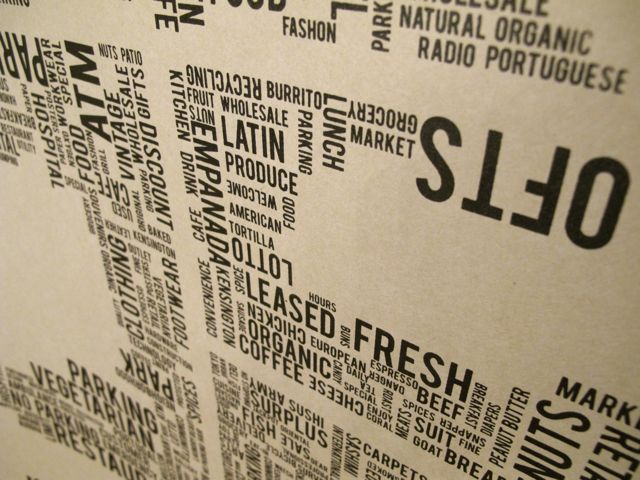
This suite of applications takes the city as its conceptual backing, generating a set of small technologies and tools that can help citizens of Windsor and visitors investigate and understand their surroundings through critique, humour, and imagination.

Why use the iPhone? Well, I’m already familiar with it for starters — I haven’t even touched an Android phone — but I’m also interested in looking at what the potentials are in the iOS world for creative intervention, and for becoming another tool of sorts to examine and understand the peculiarities of locality.

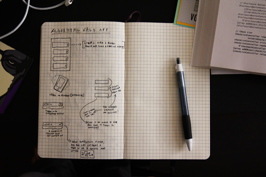
So, what are these apps going to do? I have a few ideas, and I’m in the process of thinking through a few more, but after having skimmed through some basics on iOS development, I think it’s time to start unfolding some of these on paper. And, of course, one of these apps will be based on psychogeographic / algorithmic movements in space.

This project is generously supported by the Ontario Arts Council, Media Artists Section.

New Methods for Mind Mapping

new mind mapping

Andrew Hunter up at RENDER recently lead participants at the Oakridges Moraine For Life Community Well-being Symposium in a creative mapping project designed to identify the links and barriers to progressive change. The map, pictured above, highlights barriers and connectors by using different coloured post-its alongside more illustrative mapping techniques.

I thought this could be a particularly interesting way to think through larger scale projects.

Map Text

California Map Project

Pardon me for being a little behind the times, but John Baldessari‘s “California Map Project” from 1969 strikes a chord of creativity in me. Maybe we could find a way to blend the scale of this project with the plausibility of our Google Earth rooftop idea. Basically, John Baldessari took a map of California (bottom right) and went to the places where the map letters “California” would be located, and spelled out the letters in rocks or other ways.

From the artist – “Photographs of letters that spell California and of the map used for locating the site of each letter. The letters vary in scale from one foot to approximatly one hundred feet, and in materials used. The letters are located as near as possible within the area occupied by the letters on the map. The idea was to see the landscape as a map and to actually execute each letter and symbol of the map employed on the corresponding part of the earth. It was an attempt to make the real world match a map, to impose a language on nature and vice-versa.”

My Neighbourhood; A Tag Project

tagging_project

With the help of Panoramio, a site that allows users to upload images and plot them using Google Maps, I created a project where I mapped the routes that I walk on a weekly basis. I did this by photographing the tags I see on my walks, then plotting the images on the map. There are three main taggers in my neighbourhood; Beast, THC and Jerk. I tagged the appropriate photos on Panoramio with the names of these taggers. I plan on extending this project to include more images of tags in other neighbourhoods around Windsor and opening it up to others to contribute their images as well.

Check out the photos here.

More BCL+maps

A Vending Cart of Maps

Making Maps by People, then putting them on a vending cart, project by Katy Asher

With our interest in mapping (and using the fancy technology of Google Maps to try to do so), I thought it might be interesting to post on this project, which is very much not about fancy technology. Katy Asher, a student in Portland’s MFA in Art and Social Practice program, along with Ariana Jacob and Amber Bell, have initiated a project that “aims to make a vending cart of maps made by people from Portland.”

This feels like an intersection of a number of projects we’ve discussed and are also ongoing in the community, and makes me wonder what subjective maps would look like for other Windsorites. Asking for people to map their routes to work, their favourite restaurants, their neighbourhoods would certainly provide an interesting look at the way distances and geography are collapsed or exaggerated and might help to discover some other broken parts of our city and the way it functions (or doesn’t).