Welcome to the Neighbourhood

Welcome to the Neighbourhood

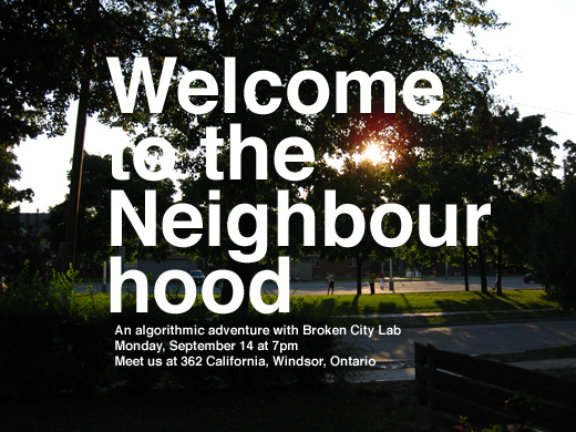
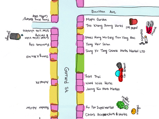
We’re hosting an algorithmic adventure to get to know our new neighbourhood. This adventure will be a psychogeographic walk of sorts starting at Broken City Lab Headquarters, which will take participants around the campus, student ghettos, the sculpture garden, Indian Road, and all of the little things that make this area worth exploring.

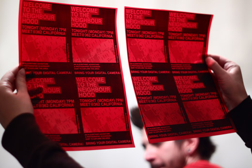
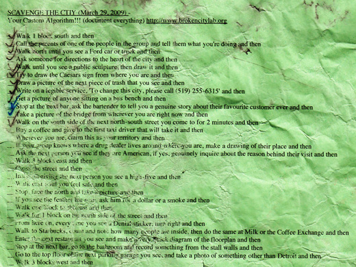
Everyone who shows up will get into small groups and share a list of instructions that will take them around the neighbourhood. These instructions will involve moving in specific directions, taking on specific tasks, and generally paying specific attention to the area around you. At each step in the algorithm, you’ll be asked to take a single photograph. At the end of the algorithm, when you return to BCL HQ, we’ll download your photos and upload them to our site to create a set of very specific views of the neighbourhood and generate a body of research on West Windsor much greater than we could ever do on our own.

This event will launch our fall activities and be the first of many open-house type events / workshops / office hours for 2009 / 2010!!!

The details:

Monday, September 14, 2009

Start at 362 California Ave at 7pm

End at 362 California Ave around 9pm

Bring your camera and bring a friend!

Psychogeographic Map: East Chinatown’s living and dead businesses and their smells

psychogeographic map

This is a small excerpt of a large map made by students in OCAD’s Cities for People summer workshop, depicting the East Chinatown neighbourhood, its businesses and their smells.

You should take a look at the larger map, which helps to demonstrate the potential in mapping outside of the continually pervasive Google Maps.

To take time to note a neighbourhood in this somewhat peculiar detail is an interestingly necessary method for interfacing with a place one might normally walk by, and in turn, of course, makes me eager to do the same somewhere around these parts.

[via Spacing]

Scavenge the City Recap

the algorithm

A week ago, on an incredibly cold, rainy, snowy evening, we headed out on an exploration of Windsor’s downtown guided by a randomly assembled algorithm for Scavenge The City. We only made it through the first 20 steps (we stopped checking them off though), plus a couple others we skipped to by the end, but for the two or three hours we were out, it was great to experience the city with new people in new ways.

To see the algorithm, you can view it randomly assembled, refresh it to see a new order.

Continue reading “Scavenge the City Recap”

Graffiti Using GPS

Invisible Bombing, GRL Tokyo

This project, executed by GRL Tokyo, took me a while to figure out. Basically this image, which reads “The Invisible is Eternal,” was made by riding a bike with a GPS device attached to it, then uploading the resulting kml file to Google Maps. It’s pretty insane to see this that this was done on a bike, though aside from that, I’m not sure about it (and the 19 minute video of the condensed bike ride doesn’t help either).

Maybe something is lost in the translation, but I think conceptually, this would have been better as a map made as a kind of algorithm to move the rider over some greater distances than he normally would, then documenting the experience of that process. Of course, in terms of how it was actually executed, that description is probably pretty close, but the reason behind doing it is different (writing / bombing without actually making a mark vs psychogeographic interests), and ultimately kind of dull.

I thought it was worth noting, given some of the Google Earth related projects we’re working on.

A Vending Cart of Maps

Making Maps by People, then putting them on a vending cart, project by Katy Asher

With our interest in mapping (and using the fancy technology of Google Maps to try to do so), I thought it might be interesting to post on this project, which is very much not about fancy technology. Katy Asher, a student in Portland’s MFA in Art and Social Practice program, along with Ariana Jacob and Amber Bell, have initiated a project that “aims to make a vending cart of maps made by people from Portland.”

This feels like an intersection of a number of projects we’ve discussed and are also ongoing in the community, and makes me wonder what subjective maps would look like for other Windsorites. Asking for people to map their routes to work, their favourite restaurants, their neighbourhoods would certainly provide an interesting look at the way distances and geography are collapsed or exaggerated and might help to discover some other broken parts of our city and the way it functions (or doesn’t).

Psychogeography Walk in Windsor

Pedestrian scramble time-lapse by Sam Javanrouh, from Spacing Magazine

Tomorrow night, December 28th, at 8pm, Spacing Magazine‘s Shawn Micallef  (in conjunction with Scaledown.ca and InternationalMetropolis.com) will be hosting a Psychogeographic Walk through Windsor. The walk will start and end at Phog and will consist of a simple algorithm to get people moving through the city. After everyone comes back, the routes will get mapped, highlighting discovered details and personal landmarks. 

For more information and to hear the PSA running on CJAM, check out the post on ScaleDown.

PS. The image above has nothing to do with Windsor or psychogeography, but is a still from a Pedestrian Scramble time-lapse video made by Sam Javanrouh that I saw (and liked) on Spacing Magazine’s website.