
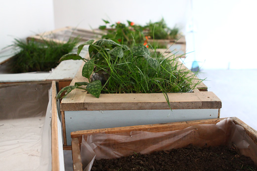
The weekend brought all of the artists together to collaborate on each other’s projects. The Imagination Lab engaged lots of young creative minds, and Thom Provost began work on his installation.
The weekend brought all of the artists together to collaborate on each other’s projects. The Imagination Lab engaged lots of young creative minds, and Thom Provost began work on his installation.
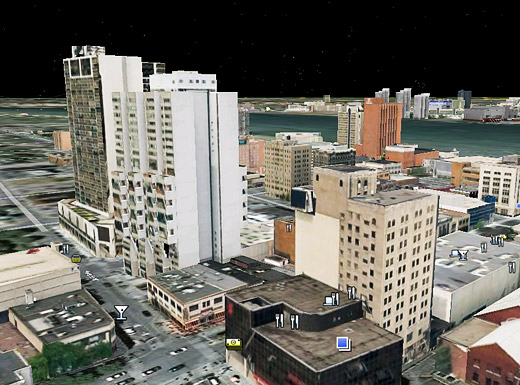

As previously noted on Windsor Visuals and Tom Lucier’s Twitter (via Planetizen), a number of buildings in Windsor and Detroit are now on Google Earth in all of their SketchUp-rendered glory.
It’s quite interesting to fly around and see what buildings have been modeled, not all of which have been done by the SketchUp team, but by local folks with the talent and skill to do it.
I think this is going to help us with a number of projects, since we love to do Photoshop renderings to imagine projects … having the ability to see those renderings on 3D objects can only make things that much easier. I just wish one of us knew how to use SketchUp.
Continue reading “3D Renderings of Buildings from Windsor + Detroit on Google Earth”
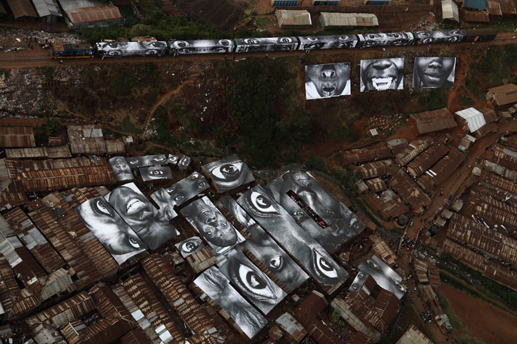
This is a huge project. JR, an “undercover photographer,” recently completed this large-scale photo installation on the rooftops of Kibera, Kenya. The photos on the roofs are of Kenyan women and are printed on water-resistant materials, thereby providing the homes with some protection in the heavy rain seasons, while the hillside also features faces that are split, but completed when the train passes through Kibera twice a day.
The scale of this project is incredible, but I really like that the photos also protect the homes beneath them.
[via Wooster Collective]
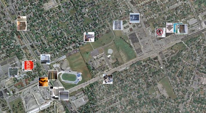
With the help of Panoramio, a site that allows users to upload images and plot them using Google Maps, I created a project where I mapped the routes that I walk on a weekly basis. I did this by photographing the tags I see on my walks, then plotting the images on the map. There are three main taggers in my neighbourhood; Beast, THC and Jerk. I tagged the appropriate photos on Panoramio with the names of these taggers. I plan on extending this project to include more images of tags in other neighbourhoods around Windsor and opening it up to others to contribute their images as well.
Check out the photos here.
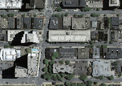
From what I understand, Google Maps updates once a year or so (I’d guess even less than that). So, I think now would be a good time to start on a project like this, as according to these maps, Caesar’s Windsor is still under construction.
That parking garage on the corner of Park and Pelissier would be a fantastic candidate for a project like this. I think noting to the world that “we’re still alive” is going to be increasingly important, as Windsor continues to have the highest unemployment rate in Canada.