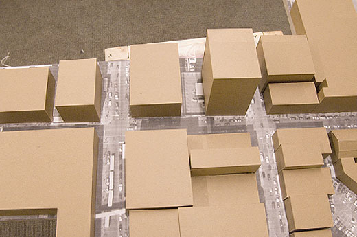
Windsor Archives

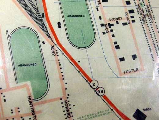
a map of Windsor

I went to the Windsor Archives at the downtown Windsor Public Library with Lee Rodney’s Border Culture class on Thursday. The city’s archives are uninsured and sit in the basement, in the same room as the water main for the building, with some record books, maps, and architectural drawings un-boxed and unprotected, though most looked to be in acid-free (though certainly not water-proof) boxes.

The map above was one of the many articles from the archive we got to see, and I think it dates to sometime in the 1950s. Interestingly, there are these areas marked as abandoned, and it made me think back to our beginnings at a Google map that marked out, among many things, some of the abandoned properties (in particular, the abandoned big-box stores).

I’m curious as to why these areas were ever marked as abandoned, though unfortunately I didn’t note what kind of map this was. If anyone has any guesses, let me know.

So, the Windsor Archives are a really interesting place if you’ve never been, and the archivist that we met with seemed very eager to help with researching. With over 10,000 photos alone, on top of thousands upon thousands of other documents, I think it’s worth exploring further.

They also accept contributions.
Talk20 / Pecha Kucha

Talk20 in Windsor, Ontario at Artcite

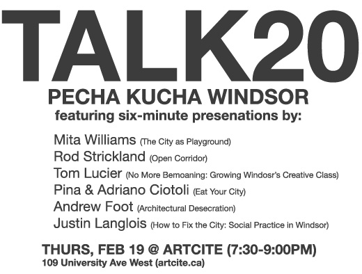
Organized by local artist Jodi Green, the Windsor iteration of Talk20 happens on Thursday, February 19th, and will feature six-minute presentations by Mita Williams, Rod Strickland, Tom Lucier, Pina and Adriano Ciotoli, Andrew Foot, and Justin Langlois.

“Talk20 is not a lecture but a gathering, an open forum for the dissemination of ideas in art, architecture and design.  Produced in cities around the world talk20 has emerged as a live catalogue of contemporary creative production that seeks to instigate a conversation within and without the design community.”

The presentations start at 7:30pm at Artcite. See you there!

Victory Gardens

Victory Gardens, a community art project that encourages people to grow their own food

Victory Gardens is a new project by Amy Franceschini. The project recalls the WWII victory gardens project that encouraged citizens to grow their own food as a tactic to keep them calm over the war and support their troops. Franceschini, the daughter of an organic farmer and an industrial farmer, takes the project back to where it began—in front of the city hall buidling in San Fransisco, where they planted a large garden and since introduced a pilot project to disseminate the skills and tools needed to do urban-scale gardening across 15 households throughout San Fransisco.

There’s also a write-up on the SF Victory Gardens 2007 project in the previously mentioned JoAP.

I know FedUp is working really hard in this city, and that Tom Lucier proposed planting a garden for the downtown mission, and that Scaledown once (maybe) suggested the old Greyhound station downtown is turned into some kind of market, and that there’s rumours of a symposium surrounding urban activism that may discuss some of these very things… so (since this is what BCL does) I have to suggest that we move forward with the planning for a large-scale urban/community gardening plan, something like turning 10% of the riverfront into a community garden (maybe on the slopes that lead up to University Ave). Anyone interested?

[via]

My Neighbourhood; A Tag Project

tagging_project

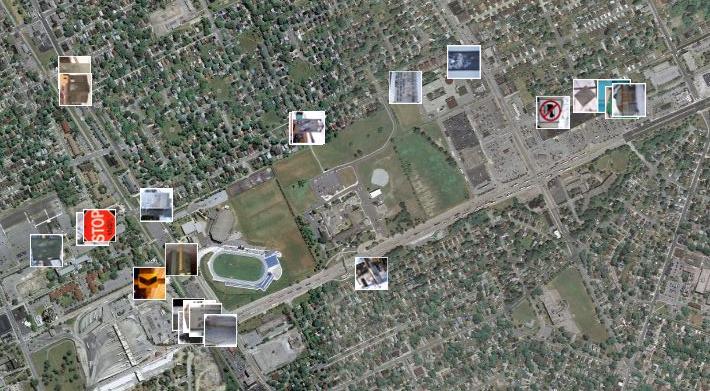
With the help of Panoramio, a site that allows users to upload images and plot them using Google Maps, I created a project where I mapped the routes that I walk on a weekly basis. I did this by photographing the tags I see on my walks, then plotting the images on the map. There are three main taggers in my neighbourhood; Beast, THC and Jerk. I tagged the appropriate photos on Panoramio with the names of these taggers. I plan on extending this project to include more images of tags in other neighbourhoods around Windsor and opening it up to others to contribute their images as well.

Check out the photos here.

More BCL+maps

Algorithmic Walk

Algorithmic Walk for Border Culture

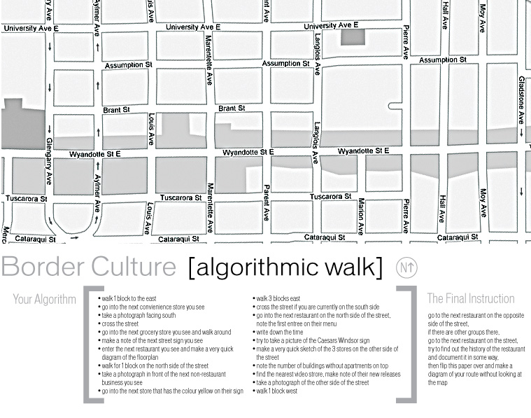
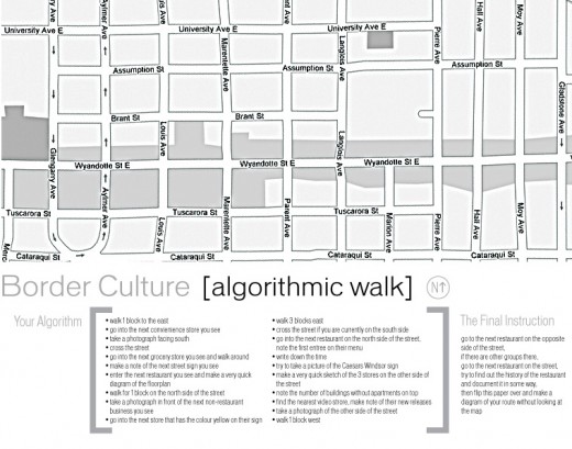
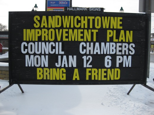
Last Thursday in Lee Rodney’s Border Culture class, we went out on an algorithmic walk to explore Wyandotte from Glengarry to Gladstone. The students were given the algorithm and map I made that you see above, but with varying order, and then sent out. As the goal was to have the students become familiar with the many grocery stores, restaurants, and commercial / architectural / commercial peculiarities of the area, the algorithm was based around specific instructions to guide them to pay closer attention to details through photographing, sketching, and noting, rather than an algorithm to guide them down different streets. 

I think the walk (and algorithm) went over pretty well. We’ll be looking at all the students documentation and hearing about their adventures this week in class (some students have already started posting on the Border Culture blog), but I think something like this on a larger scale would be another great addition to the ongoing walking series that have been led or initiated by Tom Lucier over the last few months. We’ve spoken about this before, but now we just need to set a date.

Annotating Windsor

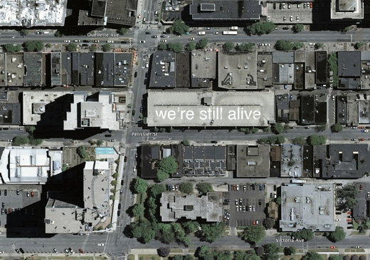
we're still alive: a message to the world, annotating Windsor on the rooftops of parking garages, by Broken City Lab

From what I understand, Google Maps updates once a year or so (I’d guess even less than that). So, I think now would be a good time to start on a project like this, as according to these maps, Caesar’s Windsor is still under construction.

That parking garage on the corner of Park and Pelissier would be a fantastic candidate for a project like this. I think noting to the world that “we’re still alive” is going to be increasingly important, as Windsor continues to have the highest unemployment rate in Canada.

A Vending Cart of Maps

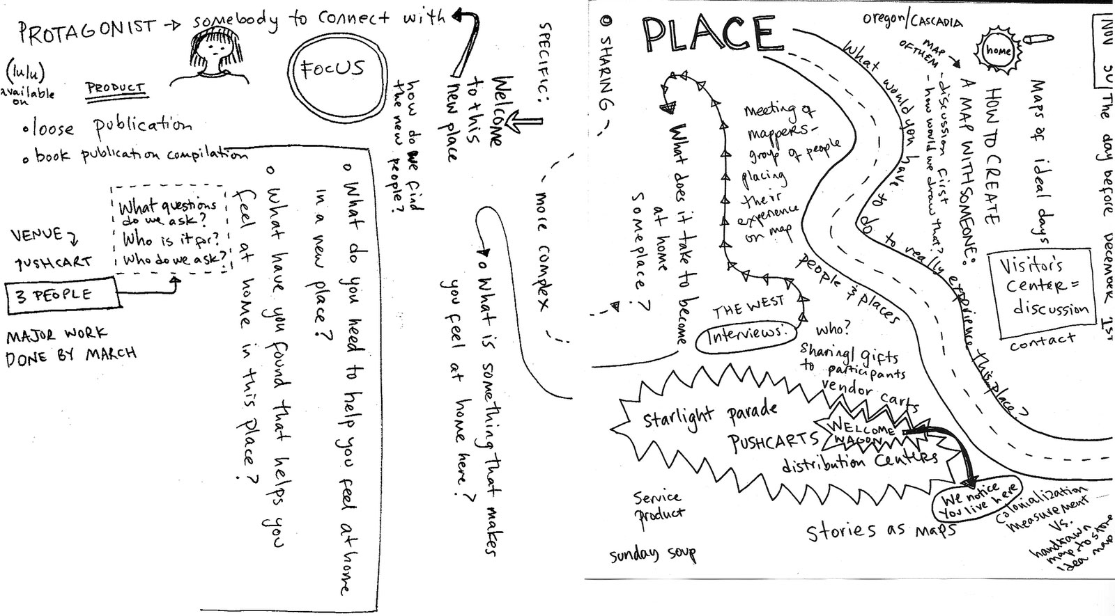
Making Maps by People, then putting them on a vending cart, project by Katy Asher

With our interest in mapping (and using the fancy technology of Google Maps to try to do so), I thought it might be interesting to post on this project, which is very much not about fancy technology. Katy Asher, a student in Portland’s MFA in Art and Social Practice program, along with Ariana Jacob and Amber Bell, have initiated a project that “aims to make a vending cart of maps made by people from Portland.”

This feels like an intersection of a number of projects we’ve discussed and are also ongoing in the community, and makes me wonder what subjective maps would look like for other Windsorites. Asking for people to map their routes to work, their favourite restaurants, their neighbourhoods would certainly provide an interesting look at the way distances and geography are collapsed or exaggerated and might help to discover some other broken parts of our city and the way it functions (or doesn’t).

COLAB

COLAB is based out of Syracuse and is an interdisciplinary program that works in design, art, policy, etc towards real solutions

COLAB is an interdisciplinary program run out of Syracuse University that pushes students to learn how to approach problems collaboratively and share multiple perspectives while working toward creative solutions. Their website is still coming together, the few posts on there are mostly videos / slideshows showing students working on various projects, but it looks like some really interesting things could come out of it.

The thing that caught my eye was this charrette competition, which partnered students from various disciplines over a weekend to come up with ideas and visions for the revitalization of a core downtown area. The competition was sponsored by the Syracuse Chamber of Commerce, and some students will stay on with the Chamber to continue in the planning of moving forward with some of the proposed changes.

Not that I necessarily want to get into this discussion, but I might bring up the University of Windsor‘s logo at this point. Rumours put the price tag of this gem at around $1 million (which I’m sure includes the surrounding “branding” program). The majority of reactions to the logo, as I’ve heard them, begs the question—why not engage students in the design process, or ask them to design it, period? Why wouldn’t this University (or even the city) ask for students to contribute on a regular basis to (at the very least) reimagining, well, everything? How is anything in this city going to be pushed forward if planning is continually done behind closed doors, without the input of the real stakeholders? For now, it likely won’t. 

At any rate, it’s alright that no one is asking, because in reality this just gives us more to work with.

Psychogeography Walk in Windsor

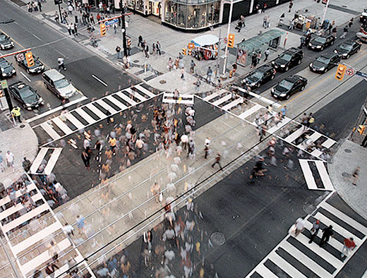
Pedestrian scramble time-lapse by Sam Javanrouh, from Spacing Magazine

Tomorrow night, December 28th, at 8pm, Spacing Magazine‘s Shawn Micallef  (in conjunction with Scaledown.ca and InternationalMetropolis.com) will be hosting a Psychogeographic Walk through Windsor. The walk will start and end at Phog and will consist of a simple algorithm to get people moving through the city. After everyone comes back, the routes will get mapped, highlighting discovered details and personal landmarks. 

For more information and to hear the PSA running on CJAM, check out the post on ScaleDown.

PS. The image above has nothing to do with Windsor or psychogeography, but is a still from a Pedestrian Scramble time-lapse video made by Sam Javanrouh that I saw (and liked) on Spacing Magazine’s website.