I made an iPhone App and so can you !!!


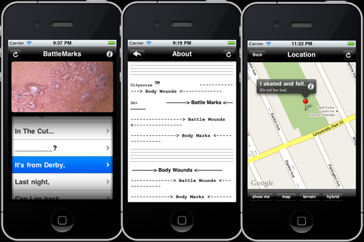
For one of my last projects with Sigi Torinus as part of my BFA degree I made an iphone App.

I was able to speed up a usually lengthy process by skipping over the coding portion of creating the app. This was made possible by using Buzztouch, a web-based content management software (CMS) out of Montery California that helps build iPhone and Android apps. Buzztouch provides tools that allow people to create mobile apps and provides a back-end database to support those apps over the long-term. They do both of these things for free, for anyone. The source-code that app owners download for each of their applications is released under an open-source license.

Continue reading “I made an iPhone App and so can you !!!”

Rolling Economy

Last Wednesday at The Green Corridor‘s Drive-thru Symphony event I showed a projection entitled Rolling Economy. This site-specific piece served as a digital representational count of the Windsor-Detroit border trade that passes through the corridor. The piece, which lasted about an hour, was visible to those in cars and trucks coming off of the Ambassador Bridge.

Rolling Economy

Rolling Economy2

My Neighbourhood; A Tag Project

tagging_project

With the help of Panoramio, a site that allows users to upload images and plot them using Google Maps, I created a project where I mapped the routes that I walk on a weekly basis. I did this by photographing the tags I see on my walks, then plotting the images on the map. There are three main taggers in my neighbourhood; Beast, THC and Jerk. I tagged the appropriate photos on Panoramio with the names of these taggers. I plan on extending this project to include more images of tags in other neighbourhoods around Windsor and opening it up to others to contribute their images as well.

Check out the photos here.

More BCL+maps