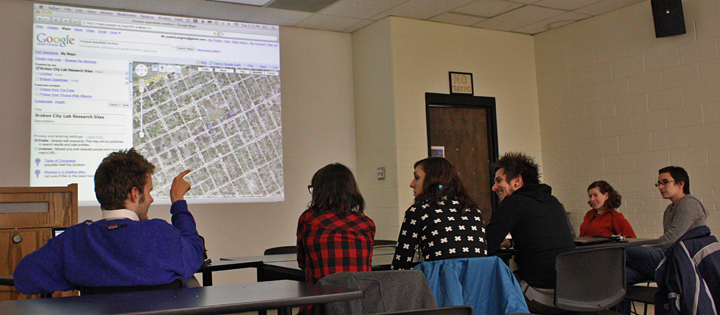
We spent a couple hours last night highlighting areas in Windsor that are of interest to us, either as potential research sites, potential exploration sites, or places in need of further examination. If you have anything that should be added to the map, please do so, but in order to edit it, I think you need a Google account. In particular, it would be good to build a better directory of places for rent in the downtown core. I also tried to make a screencast of the discussion and mapping, but having some difficulty getting it to export—I’ll post it when/if I can get it to work.
Photo by Darren.
This is relevant to my interests. Will this be discussed at the next meeting (this thursday)?
Our next meeting will be next Tuesday at 7pm, though I’m not sure how much we’ll continue this mapping stuff at that point. It would be good to plan another round of mapping as a group, but I think for the time being, it’d be good to get any contributions via Google Maps (I think it’s set to public, so anyone can use it..) The experience of doing it as a group was really great, but also tiring… So, if you want to come out to the meeting and have a conversation about the map, or the process, or whatever, of course you are more than welcome!!!
DUDE(s)! This is AWESOME! You guys are officially the third group that has expressed an interest in “Asset-Mapping” our fair city. We really need to coordinate this and make it the best we possibly can. Contact me at chris@scaledown.ca soon, as I would like to invite one of your “mappers” to a meeting on Thursday afternoon…
Hi Chris!
it would be great to do some more mapping with other people with different takes on the city. I’ll send you a note, hope to catch up soon.