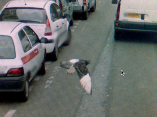
We’ve posted about the emerging Google Street View found photography sub-genre before. Michael Wolf is another artist using found GSV images to capture the absurd, banal, and occasionally poetic existence of modern street life. When compared with candid photography, Google Street View images present an infinitely larger database of frozen moments which were never intended to be seen as anything but instructional. Wolf has sifted through these images and presented to us an account of Paris at one moment in time.
Expect More Activity + How Do You Collaborate Online?
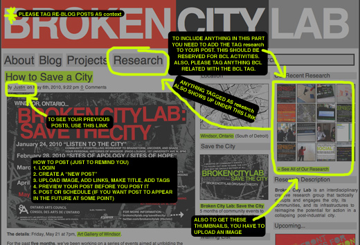
Be it resolved that we’ll be a lot more active on here starting now.
We’ve been overly involved in communicating on Google Wave while trying to keep our brains together for Save the City. With that project winding down, we’ll be shifting more of our research and communications back on here. We’ve missed it.
And Josh said it best when he suggested that we should’ve been using the blog instead of Google Wave the entire time. He’s completely right.
Using that fancy collaborative tool that Google seemed to suggest would be the future of email never really fit into our work flow all that well, but it seemed the most convenient for having notes and research in one place. At first, maybe kidding ourselves, we thought it would do away with multiple emails back and forth, but then we kept forgetting to check our waves, so then we opted-in to receive emails when a Wave had been updated, and so it became really no better than a bunch of emails and some Google documents.
We’re always looking for ways to make this process better. We seem to lose so much in translation from discussions to the next time we meet up or begin working on something new. Should we be saving Word documents to Dropbox? I know Cristina and I have been using it to pass photos back and forth and its fairly convenient, though we haven’t tried working on the documents from there — I suppose we’re using it as a glorified FTP. Google Docs kind of works, but is somewhat annoying to have documents in two places (as I don’t think anyone is really truly committing to the cloud yet). What do you use when you’re working on something with someone else? How do you resolve multiple files with the same names?
With our goal (really this time) of trying to put together some kind of publication soon(ish), what’s going to be the best way to keep ourselves on the same page, or at the very least, merge everything together at the very end?
Any regular readers — what’s your method(s) for collaborating online? BCL, any suggestions for how we should move forward with this?
What is Google trying to tell us?
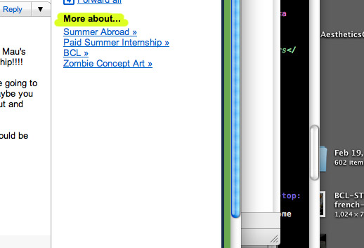
Danielle first wrote about the Gmail ad phenomenon a while ago — that is, how Google tries to place relevant ads by reading your emails and the curiosities that can arise from that technique.
So, the screenshot above is what Google thinks about an email regarding Broken City Lab, Bruce Mau, a revisited idea, and our new upcoming residency project.
Google Street View of Windsor Online
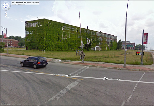
We’ve been waiting for this for a while, but Google Street View’s drive through Windsor is now up online and available.
Google’s tour took place in the midst of our 101 city workers strike, but too early into it to have (and thanks to the note from Steven) caught our Naturalized Area signs. At any rate, I’m looking forward to having the time to go through our city from seven months ago and explore.
It might also be a good way to start brainstorming for our upcoming Sites of Apology / Sites of Hope event!
So, start exploring.
[via Rob’s Twitter & windsoriteDOTca]
Google Street View’s Street Photography
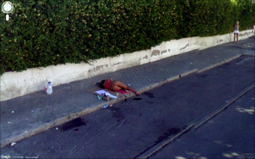
“A street view image can give us a sense of what it feels like to have everything recorded, but no particular significance accorded to anything.”
In a guest post over at Art Fag City, Jon Rafman presents an excellent image essay on Google’s Street View feature and the many amazingly curious images its roving cars have caught since its inception two years ago.
Collected from blogs and his own Google Maps usage, Rafman pulls some of the most compelling images from Street View and attempts to articulate both the importance in studying this growing mass of images captured by computer-controlled cameras and the implications of us, as human beings, continuing to place meaning onto their subject matter, their composition, and their moral implications.
I was certainly taken by a number of the images, and undoubtedly by the writer’s design, I began to wonder what it means to see these very selected images pulled from their contextual frame of more streets, more people, and less interesting combinations thereof.
Consider this a must-read.
[via Art Fag City]
Google Street View is Coming to Windsor
Google’s Street View service is making the rounds across Canada. There’s no schedule that I’ve been able to find yet, but they are coming to Windsor.
Anyone have any ideas about when Google is coming to town?
And maybe as a follow up, anyone have any ideas?
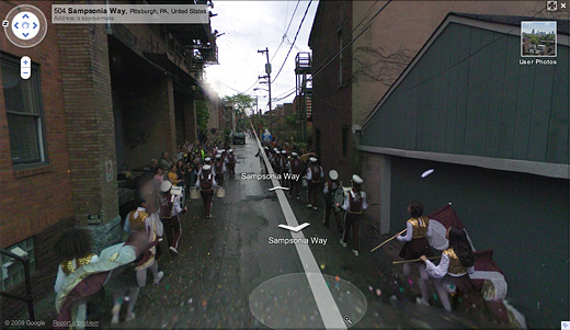
There’s already a short history of artists working alongside Google’s team. In 2008, artists Robin Hewlett and Ben Kinsley invited the Google Inc. Street View team and residents of Pittsburgh’s Northside to collaborate on a series of tableaux (pictured above), but to not at least think about doing something would certainly be a waste. How often do you think this could possibly happen?
I wonder if a well-placed, but legible, banner might be worth investigating?
[via CBC]
Turning Crisis into Opportunity

See the Opportunity developed by Leo Burnett Lisboa and Arc Lisbon is a Firefox plugin that automatically replaces the word crisis with the word opportunity throughout your internet travels.
Not unlike Steve Lambert’s Add-Art, this is another great use of the extensibility that is the Firefox plugin framework.
What are those plugins written in? Does anyone know how to do this? I think developing a Windsor-specific plugin could be a great summer project.
[via Scott Burnham]
Annotating Windsor
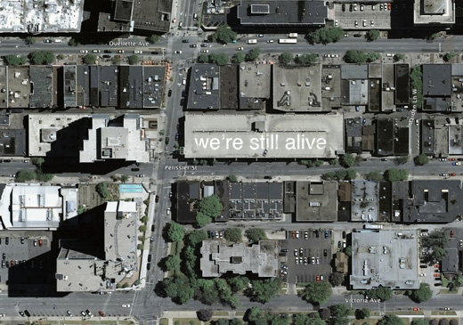
From what I understand, Google Maps updates once a year or so (I’d guess even less than that). So, I think now would be a good time to start on a project like this, as according to these maps, Caesar’s Windsor is still under construction.
That parking garage on the corner of Park and Pelissier would be a fantastic candidate for a project like this. I think noting to the world that “we’re still alive” is going to be increasingly important, as Windsor continues to have the highest unemployment rate in Canada.
Mapping Windsor, Round 1
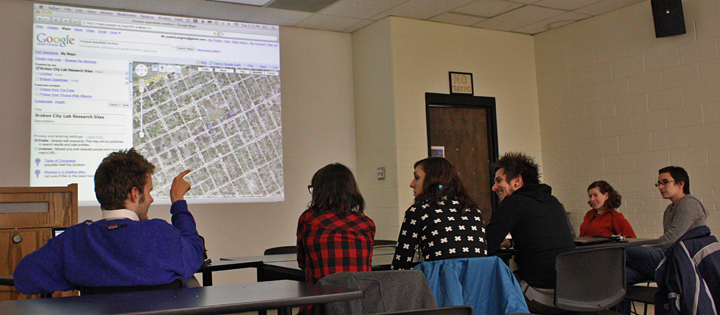
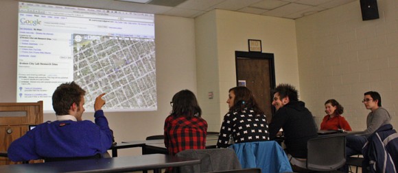
We spent a couple hours last night highlighting areas in Windsor that are of interest to us, either as potential research sites, potential exploration sites, or places in need of further examination. If you have anything that should be added to the map, please do so, but in order to edit it, I think you need a Google account. In particular, it would be good to build a better directory of places for rent in the downtown core. I also tried to make a screencast of the discussion and mapping, but having some difficulty getting it to export—I’ll post it when/if I can get it to work.
Photo by Darren.
Mapping Windsor
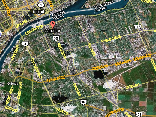
Next Tuesday night, December 2nd, at 7pm, Broken City Lab will be holding a Social Mapping Event, where we’ll use the tools Google gave us and highlight potential study areas (and broken points of interest)—the Google Map itself will be made public afterwards. We’ll also make a screencast of the process and make it available on the website afterwards.
So, if you’ve been meaning to come out to our weekly Office Hours, but haven’t had the time yet, clear your schedule for next Tuesday.

