Power House Detroit: Artists as Community Leaders

I’ve written about Power House over in Detroit before. Mitch Cope and Gina Reichert of Design99 started this Hamtramck-based neighbourhood project a couple of years ago now. Able to take advantage of the radically declining real estate market, they bought up a house for $100 and have since been working in the neighbourhood on small and large scale projects that tackle the potential of art affecting change.

They’ve since been featured in exhibitions at the DIA‘s project space and at MOCAD, but the really interesting stuff is, of course, happening on the ground. Juxtapoz assisted Cope and Reichert in buying more foreclosed homes to be used as project spaces, Power House is now Power House Productions and a formal 501(c)(3) Non-Profit, and they’re thinking about doing things like creating a Neighborhood Bike Shop and Skate Parks and Bike Courses.

Model D‘s latest article on Power House Productions frames the work well:

They’ve been organizing block clubs with their neighbors where they’re tackling everyday concerns like garbage pickup and snow removal — not ruminating on notions of gentrification and art theory. They are knee deep in the notion and practice that art can fuel community development — and not necessarily just the community that typically “consumes” art.

So, art as social practice? Certainly, yes. This work will undoubtedly become a touchstone for writing around social practice, publicly-engaged practices, and contemporary art at the end of first decade of the 2000s. However, even framing the discussion around art is perhaps doing the project (and neighbourhood) an injustice. These artists are taking on the role (or is it responsibility) of being community leaders in the neighbourhood — artists as community leaders. Not artists performing the role of a community leader, not artists creating an exhibition on community leaders, not merely facilitating workshops on what it means to be a community leader, but really stepping into a role that raises a lot of questions and maybe, just maybe, does some real good.

And there are questions, of course. One has to wonder about what’s at stake when a real neighbourhood becomes an art project (and we have to look no further than the Heidelberg Project to see some of these implications), and one also has to keep a suspicious eye open around issues of gentrification, or the parachute effect of public art practices,  or even just the moral and ethical dilemma of spurring a kind of development in a place that didn’t necessarily ask for it.

For the moment though, I think we need to step outside of those issues and look at the project with some fresh curiosity. Perhaps aside from the 17-year-long Project Row Houses, there isn’t a readily available model to understand this kind of art practice, and I’m ready to start wondering about what a model of artists as community leaders/activators/instigators with a long-term investment can do to change a place. And of course I’m curious — that’s pretty much what I hope we’re doing here.

via Model D Media

The Lot in Detroit: A Traveling Public Art Exhibition & Model for Temporary Use Spaces

Back in 2009, Kathy Leisen, an artist living in Corktown, Detroit, started using a vacant lot next to her house as a public art venue. She called it The Lot. And there are big letters to demarcate the space. The Lot is now less a particular vacant lot than an idea for using many vacant lots. From The Lot‘s website:

The Lot is an open space. A venue for art, creative thinking and performance, the lot is a curatorial project […] the lot is a transient artspace partnering with friends, strangers, and organizations.

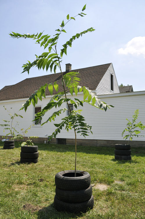
The lot uses empty city lots. Typically, this means hard clay earth, crab grass and other weeds, and unexpected debris. Manipulating the land is ok. Landscaping is ok. Bringing in outside materials is ok. For example, proposals so far have included: creating a cemetery, hut sounds (sounds emitted from a hut), arranging an archeological dig (ancient cheetos wrappers), making a gallery of inflatables, and holding african dance classes.

There’s a range of projects detailed on The Lot‘s website, but maybe the best part of it is just the idea of coming together in a new place and doing something. Local artists are paired with out of town artists for each exhibition. Leisen prepared the original lot by picking up chunks of concrete in her downtime. She got to know her neighbours, brings together friends and strangers, and she frames this activity around the following idea: “We live here for a reason.”

As of late, The Lot has become a traveling public art exhibition, a pop-up exhibition of sorts, taking on an increasingly helpful and critical approach to using space temporarily. Often this temporary use by artists allows for the venue to be left in better condition than when it was found. We know — after SRSI, those storefronts were in a lot better shape than when we first moved in.

And that seems like a pretty fair trade-off. Temporary use of space for free, as long as we somehow improve the space before we leave.

Maybe we should draft some sort of agreement to arm folks in this city with something formal looking so they can start approaching landlords. Free space for a limited time, we’ll repaint, clean, landscape, etc. And, I’ve suggested it before, but the lot next to the AGW would be an amazing community space, why don’t we activate it?

Theoretical Geography: Bill Bunge and the Quantitative Revolution

Canadian Minorities by Zachary Johnson 2005

Zachary Forest Johnson is (according to his bio page) a cartographer specializing in online maps and information visualizations. He is in the second year of a M.S. program in Cartography and GIS at the U of Wisconsin. In a previous life, he studied Political Science (gaining a BA from the U of Arkansas and a MA from the U of Wisconsin). His other passions include running, politics, typography, and gin and tonics.

Zachary is also the author of the blog indiemaps.com, an interesting blog on contemporary mapping methods using HTML and Java to produce interactive mapping systems and interfaces, various information on historical figures and news. Based on Zachary’s previous education, as outlined above, a certain geo-political undertone can be felt throughout the work; which is a conceptual framework that is at times hard to take at face value (nor should it be) since it is employing abstract data to map something like a countries extent of “freedom” (see Johnson’s “World Freedom Atlas“).

Continue reading “Theoretical Geography: Bill Bunge and the Quantitative Revolution”

A Tree Grows in Detroit

Ailanthus altissima, a name that may not be in any way familiar, though there is a very good chance that a person who lives in the urban centers of Windsor or Detroit sees this “ancient” tree on a daily basis. This tree is known as “Tree of Heaven” or to some “Tree from Hell.”

The tree of heaven is a native to northeast China and Taiwan, it thrives in temperate climates and is capable of reaching heights of 15 meters in 25 years, though it has a relatively short lifespan of 50 years. What might be the significance of this tree you may ask. Well, it’s on the forefront of the cultural mythos of Detroit’s current revitalization.

This is not the first time that the Tree of Heaven has been reclaimed as an icon for cultural growth in circumstances and environments of neglected or “broken” urban centers. In 1943, Betty Smith wrote A Tree Grows in Brooklyn, which features the Tree of Heaven as its main metaphor for “the ability to thrive in a difficult environment.”

There’s a tree that grows in Brooklyn. Some people call it the Tree of Heaven. No matter where its seed falls, it makes a tree which struggles to reach the sky. It grows in boarded up lots and out of neglected rubbish heaps. It grows up out of cellar gratings. It is the only tree that grows out of cement. It grows lushly…survives without sun, water, and seemingly earth. It would be considered beautiful except that there are too many of it.

A Tree Grows in Brooklyn, Introduction

Continue reading “A Tree Grows in Detroit”

We Like Music, We Love Detroit

As Michelle mentioned last week, we’re doing a projection inside of The Magic Stick as part of the We Like Music Festival in Detroit this Saturday, September 18.

The organizers of We Like Music invited us to do something — so, we figured we would come up with a great big list of things we love about Detroit and then open it up to additions and have that list projected, line by line, onto the inside of th Magic Stick. We’ll be adding to that list in real-time that night using the magic of Twitter.

There’s a ton of amazing music and we’re truly lucky to be able to work alongside the other visual artists lined up for the evening. It’s going to be fun. See you there!!!

To get tickets, check out http://www.welikemusicfestival.com/tickets/

Reasons Why We Love Detroit

In preparation for our upcoming contribution to the We Like Music Festival happening at The Magic Stick in Detroit, we are brainstorming a running list of reasons why we like Detroit. This blog post will be the spot where we can bounce ideas back and fourth through comments to use in our projection of text on Saturday, September 18th.

Let me get things started here.

Reasons why we like Detroit:

-The monorail is only 50 cents

-Windsor gets to enjoy a gorgeous skyline

-Mexican Town monday nights Canadian money at par

-St. Andrew’s Hall

-The Magestic

-Red Wings fans

-Faintly hearing festivals at Hart Plaza from the Windsor riverfront

-Russell Industrial Centre

-Guerrilla Gardening

-Constant inspiration

-Windsor doesn’t seem like such a bad place in comparison

Let’s hear it dudes!

Thinking About Borders

We’ve noted before that we’re working on a proposal for CAFKA, as we’re interested in the border between Kitchener and Waterloo. Though certainly every place is bordered with another, it’s the kind of K-W relationship that intrigues us, as we’re wondering about the potential possibilities in thinking about Windsor and Detroit as D-W.

We’re wondering about examining the process of  instigating a formality that addresses one’s existence in a bordered-region that (at least from the outside) imagines itself as one coherent region to attempt to, in the first instance, create an analogy to the way that the border-complex exists here with the increasingly arduous reality of crossing the border between Windsor and Detroit, and in the second instance, imagine that changing this was as simple as creating a one-stop office to attain a regional dual-citizenship card / document / visa of some sort.

This also extends into our increasing focus in unfolding what shapes locality, and perhaps, by overlaying local concerns over other places, we might find new ways of thinking about the way locality is created here in Windsor.

Plus, we’re really interested in building some thing soon.

3D Renderings of Buildings from Windsor + Detroit on Google Earth

detroitwindsor-2

As previously noted on Windsor Visuals and Tom Lucier’s Twitter (via Planetizen), a number of buildings in Windsor and Detroit are now on Google Earth in all of their SketchUp-rendered glory.

It’s quite interesting to fly around and see what buildings have been modeled, not all of which have been done by the SketchUp team, but by local folks with the talent and skill to do it.

I think this is going to help us with a number of projects, since we love to do Photoshop renderings to imagine projects … having the ability to see those renderings on 3D objects can only make things that much easier. I just wish one of us knew how to use SketchUp.

Continue reading “3D Renderings of Buildings from Windsor + Detroit on Google Earth”