Learning About the Emerging Emergencies of North Bay

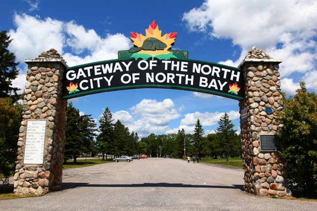
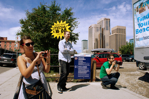
We’re in North Bay on a residency as we prepare for an exhibition this fall at the White Water Gallery. After spending Monday getting acquainted with the downtown, we ventured further out. Of course, we had to stop at the North Bay arch. Getting a sense of these kinds of structural parts of the city that have, in a way, become shorthand for the entire geography has been helping us to shape the outlines of the exhibition.

Continue reading “Learning About the Emerging Emergencies of North Bay”

New Exhibition: Unrest Everywhere (Tools for Playing with Halifax)

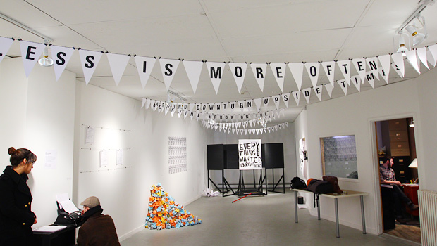
Just back from an incredible week installing at Eye Level Gallery for our show, Unrest Everywhere (tools for playing with Halifax), which runs until May 12, 2012. The show features a number of multiples and interactive works, all of which are yours for the taking and borrowing.

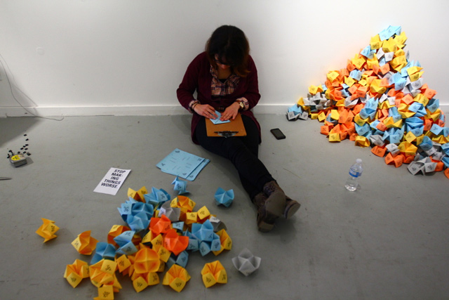
The premise for the show was to create a series of works that could directly or indirectly suggest access points for re-encountering the city and your role within it. We created works that aimed to be highly distributable, playful, and allowed a bit of critical commentary on the ways in which a sense of place comes to be planned, articulated, and established.

Below is a huge pile of documentation of the process — but first — we’d like to extend a huge thanks to all staff and volunteers at Eye Level, especially Michael and Matt, and to Emily and Kaley for the place to crash!

Continue reading “New Exhibition: Unrest Everywhere (Tools for Playing with Halifax)”

ATTC Calgary Day 1: Shortcuts for Urban Resistance & Algorithmic Walks

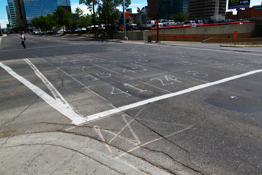
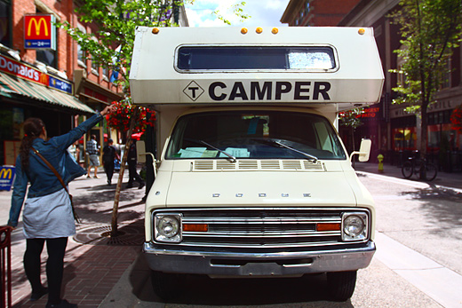
We’re in Calgary working with Truck Gallery’s CAMPER Urban Discovery project, doing a residency based on our “…and then the city…” (ATTC) research. Developed after a six-month community research project back in Windsor called, Save the City, ATTC was initially realized as two billboards in Windsor and an accompanying publication that looked at the cyclical nature of city narratives — the things that we’re told and the things we tell ourselves about the places we live.

We’re here for 10 days working to develop a practice that can begin to unfold the complexities of Calgary and how the people, architecture, infrastructure, planning policies, and connections shape this city. We’re interested in the largest sense in understanding locality in both its reading and practice, and Calgary is already proving to be a wonderfully curious research site.

If you’re in Calgary, you can catch us at CAMPER by taking a look at our schedule, and if you’re away, you can expect posts everyday on our process.

Continue reading “ATTC Calgary Day 1: Shortcuts for Urban Resistance & Algorithmic Walks”

Urban Discovery in Calgary with Truck’s CAMPER

We’re in Calgary for 9 days as part of Truck Gallery’s CAMPER 2011 Urban Discovery Project.

Here’s what’s going to be keeping us busy for the next week:

July 21 (Thurs): CAMPER Day 1: Exploding Calgary (interviews & storytelling) (12pm-3pm) 222 8 Avenue SW

July 22 (Fri): CAMPER Day 2: Spatial & Temporal Narratives of Calgary (public mapping) (3pm-7pm) 222 8 Avenue SW

July 23 (Sat): CAMPER Day 3: DIY Publication Workshop, Planning & Making Day (10am-2:30pm) 222 8 Avenue SW

July 25 (Mon): Map Making & Distro (various small maps created and distributed)

July 26 (Tues): Projection Night (Tweets & Transcripts from Citywide encounters projected from CAMPER) (9:30pm-11pm) Central Memorial Park

July 27 (Wed): CAMPER Day 4: Finding “Urban sophistication and warm western hospitality” (10am-1pm) Central Memorial Park

July 28 (Thurs): “…and then the city” publication launch (7pm) Central Memorial Park

We’re basing all of this activity off an extension of our “…and then the city” project to unfold and uncover the multiple narratives that go into shaping locality and our experience of it.  If you’re in Calgary, stop by. If you’re not, check back each day, we’ll be making epic posts.

Serendipitor & the Sentient City Survival Kit

Mark Shepard in collaboration with V2_ Institute for the Unstable Media and as part of a joint artist residency withEyebeam Art+Technology Center developed Serendipitor — an alternative navigation app for the iPhone that helps you find something by looking for something else. The app combines directions generated by a routing service (in this case, the Google Maps API) with instructions for action and movement inspired by FluxusVito Acconci, and Yoko Ono, among others.

From the project description:

Enter an origin and a destination, and the app maps a route between the two. You can increase or decrease the complexity of this route, depending how much time you have to play with. As you navigate your route, suggestions for possible actions to take at a given location appear within step-by-step directions designed to introduce small slippages and minor displacements within an otherwise optimized and efficient route. You can take photos along the way and, upon reaching your destination, send an email sharing with friends your route and the steps you took.

And, Serendipitor has also been nominated for the 2011 Transmediale Award.

This is all part of the Sentient City Survival Kit, a design research project that explores the social, cultural and political implications of ubiquitous computing for urban environments. It takes as its method the design, fabrication and presentation of a collection of artifacts, spaces and media for survival in the near-future sentient city.

While more paranoid than my own concerns, Shepard’s larger Sentient City Survival Kit certainly provides some contextualizing reference points for the iPhone apps I’m working on. It’s funny how this language around survival is somehow being tethered to mobile computing in both projects. We saw Shepard give a presentation last year when we were at Conflux, and it’s very cool to see some of his ideas being finally realized. I’m hoping for some time to download the Serendipitor this weekend.

I showed this in my Ways of Knowing class this morning — lots of fun!!

[via Pop-Up City]

Theoretical Geography: Bill Bunge and the Quantitative Revolution

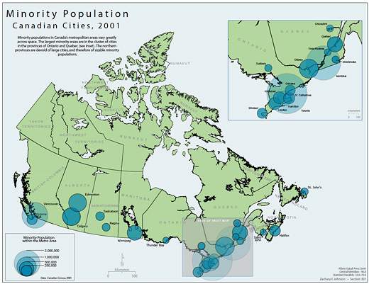
Canadian Minorities by Zachary Johnson 2005

Zachary Forest Johnson is (according to his bio page) a cartographer specializing in online maps and information visualizations. He is in the second year of a M.S. program in Cartography and GIS at the U of Wisconsin. In a previous life, he studied Political Science (gaining a BA from the U of Arkansas and a MA from the U of Wisconsin). His other passions include running, politics, typography, and gin and tonics.

Zachary is also the author of the blog indiemaps.com, an interesting blog on contemporary mapping methods using HTML and Java to produce interactive mapping systems and interfaces, various information on historical figures and news. Based on Zachary’s previous education, as outlined above, a certain geo-political undertone can be felt throughout the work; which is a conceptual framework that is at times hard to take at face value (nor should it be) since it is employing abstract data to map something like a countries extent of “freedom” (see Johnson’s “World Freedom Atlas“).

Continue reading “Theoretical Geography: Bill Bunge and the Quantitative Revolution”

Vancouver [de]Tour Guide 2010

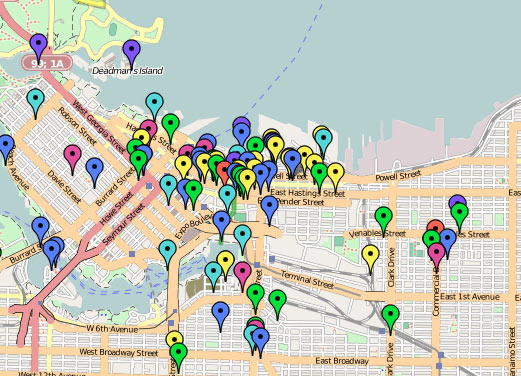
In a rather large-scale collaborative mapping project, artist Althea Thauberger and some of her colleagues are attempting to assemble an alternative tour guide, or rather, a (de)tour guide for visitors to Vancouver while the 2010 Olympic games are underway.

They set it up like this, “For us, it is vital to complicate the sanitized ‘best place on earth’ version of the city VANOC is officially promoting worldwide […] Since Google maps will be the information source of choice to visitors, we are interested in using it as a tool to critically contextualize the city during this high-profile period.”

Exploring the map provides a wide variety of points of interest, some quite interesting, others less so. The map seems to provide the most engaging information when acting as guide to local activist history, with those markers providing some spatial context for what’s happened as a grassroots political level over the last number of years (though it would be interesting to see those in relation to current Olympic-occupied places). However, as a whole, the map is a bit too unfocused to provide any really useful or critical information (and perhaps as a disinformation campaign acting in opposition to the Olympics’ official maps and points of interest, it is most successful).

Conceptually, the goal of the project to reach the front pages of Google when one searches for things to do in Vancouver is quite intriguing — I can imagine that nearly all other information one might come into contact with while in the city during this time will be stamped as an official 2010 Olympics piece of merchandise — it may be that adding suggested routes for specifically-themed tours might be a way for providing some organizational structure for all of this information.

[via an email from Josh, who we met at the Propeller show]
Welcome to the Neighbourhood Recap of Awesome Psychogeographic Exploration!!!

Welcome to the Neighbourhood

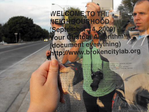
Welcome to the Neighbourhood took five groups of brave explorers on an adventure around West Windsor on Monday in order to highlight the potential to pay particular attention to the many things that usually go unnoticed in such a transient area.

Given that the neighbourhood surrounding the University of Windsor is made up mostly of student rental homes and the routes that many folks take to get to and from campus, inevitably we rarely get the chance to see some of the things that make this neighbourhood what it is.

So, two hours, three hundred photos, and many great stories later, our algorithmic walk was a huge success!

A quick warning, after the jump there’s thumbnails for the three hundred photos!!!

Continue reading “Welcome to the Neighbourhood Recap of Awesome Psychogeographic Exploration!!!”

Conflux City – Algorithmic Subway Adventure in New York City

BCL confluxcity

Back in July, Broken City Lab sent out a proposal to Conflux City 2009, which is a subset of the New York City festival for contemporary psychogeography, Conflux Festival. In August we found out that we were not only accepted into the festival, but we are also one of the featured projects of the program!

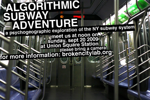
For the Conflux City 2009 program, we will be conducting psychogeographical urban research on the experiences of everyday life on the subways in New York through the activation of New York field agents. We will enlist the participation of numerous New Yorkers and visitors to the city to travel the subways and interact with their surroundings using a computer-generated algorithm that we create. This highly concentrated activity of paying attention to and disrupting the everyday on the New York subways will allow us to examine urban interactions in a well-functioning city.

In detail, participants are asked to bring their digital cameras to the walk. If they do not own a digital camera, the participants are still able to participate in the walk because we will be separating the field agents into groups, assuring there is at least one camera per section. We will provide the participants with a list of 25 randomly assembled steps in algorithmic form, and they will have a 2-hour timeslot with which to complete each of the 25 steps. We ask any one who is interested in our Algorithmic Subway Adventure to meet us at noon on Sunday, September 20th, 2009 at Union Square Station.

Photographs from the Algorithmic Subway Adventures will allow us to visually review what it means to participate in personal and community engagement in a city that we imagine being the epitome of social urban functionality. Our interest in New York as a site of this research is situated in the city’s distinct difference to our city, where the scale of urban adventure and research is not only incredibly larger, but also occurring within an entirely different context, one that is critical for us to understand in our ongoing research.

confluxcity_logo